|
|
|
|||||
The Columbia River Gorge is an 80 mile long river canyon, the majority of which was formed during the last ice age. Its a region known for its many waterfalls, some say, one of the highest concentration of tall waterfalls in the world. And it all happened with floods. The Missoula Floods, were a series of flood events which occurred around 14,000 years ago, when a super-massive glacial dam would break, thereby flooding much of the northwest, and helping to carve out the Columbia River Gorge. Most of its major tributary creeks and rivers, became waterfalls due the intensity of the gorge being literally "cut" by the flood events. Its no coincidence then, that the gorge is an amazing place to photograph waterfalls.
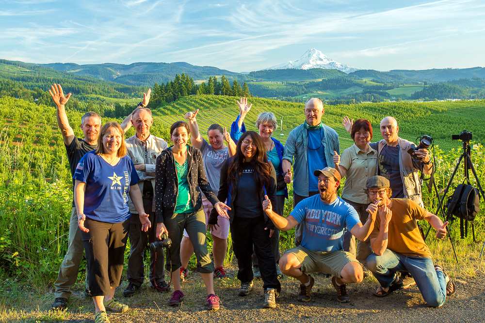
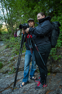
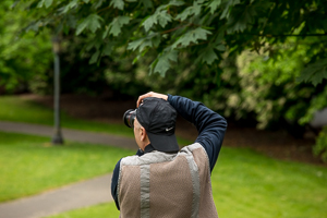
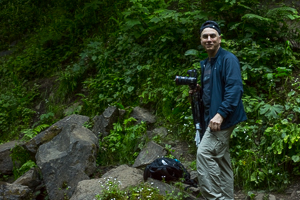
Our journey begins in Troutdale, the "gateway to the gorge." Aperture Academy Instructors Scott Donschikowski & Phil Nicholas, were on hand to guide 13 intrepid photographers through the gorge. The weather forecast was anything but ideal during our stay, bright sun and partly cloudy skies were on the docket, which means we had to alter the workshop schedule to allow ample time to photograph waterfalls in the shade, or before sunrise. We also planned on taking our group to some non-waterfall spots along the gorge, to be able to shoot when the weather wasnt favorable. All in all, it meant early mornings!
DAY 1
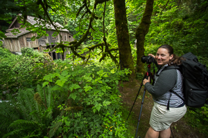
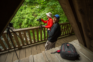
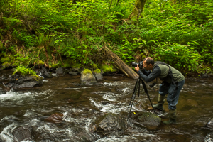
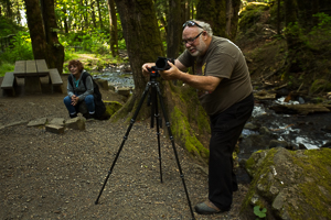
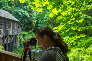
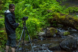
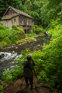 With an hour drive ahead of us, and no direct knowledge that any cloud cover would be around, a 5am departure time was needed to get out to the Cedar Creek Grist Mill. Its a mill which has been in operation since 1876, one of precious few grain grinding mills left in existence. It sits along Cedar Creek, which eventually flows to the Lewis River 3 miles downstream. Its a beautiful feat of industrial age engineering, and the structure compliments the stream and greenery all around. There are tons of photographic opportunities at the mill; above on the bridge, below on the creekbed, and to the right along a narrow path. Phil and I coached our group on the many vantage points all around the building, and after a solid hour, we broke camp and headed into Portland.
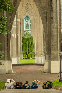
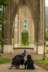
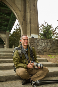
Cathedral Park is a large park which encompasses the land directly underneath the St Johns Bridge. Th bridge is a beautiful testament to the style of suspension bridges built at the turn of the century, and some say it was Portlands answer to the Golden Gate. The beautiful baby-blueish-teal paint that covers the top section, softens the scene and the greens in the park just work directly with the bridge. Its a beautiful, serene place, at least in photos! The name Cathedral Park, comes from the gothic arches underneath each tower. The repetition of these arches the length of the span makes this bridge, and park, photographically significant. We spent some time exploring different compositions underneath the bridge, before moving on to the park itself, and as the cloud cover got thicker, we decided to try our hand at sneaking in one waterfall.
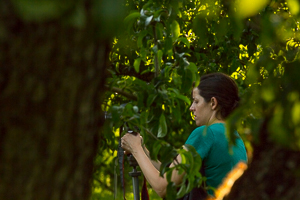
Bridal Veil Falls, is one of my favorite falls to photograph in the gorge. Not necessarily for the waterfall itself, but the beautiful wood bridge that makes up part of the trail system to the falls overlook. We split the group in two, and Phil coached up half the group on the waterfall section, while I got to show folks my favorite section of the bridge over bridal veil creek! After a while we had people filter in and out to get the most of the light, and then the sun started to rear its bright face, and we had to retreat to the shade of the hotel.
 After a break for lunch and a good nap, it was time to head out again to photograph the 249 ft Latourell falls. This time of day, Latourell is one of only a couple waterfalls in the gorge which is shaded by its basalt amphitheater. Another favorite of mine; I guess its because this one has a wood bridge too!. We spent the next hour exploring every bit of the falls, from under the bridge, to the upper trail at the top, and everything in between. Its a really cool waterfall, even though the flow is only about half (Oregons in a drought too!) With time wearing on, we headed to one last stop for the day atop the Portland Womens Forum Overlook. I think its one of the most beautiful overlooks in the state; looking east, you have an unobstructed view for nearly 30 miles up the gorge, taking in all the cliffs, hills, and mountains therein. The pinnacle of the view, is the Vista House, a circular stone observatory which also doubles as a rest area for drivers along the Historic Columbia River Highway 30. Sunset was pretty nice, with clouds illuminating far off to the east, as the last vestiges of the vista house reflected the suns light back into our cameras. What a great start!
DAY 2
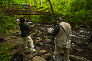
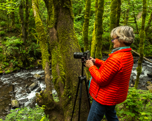
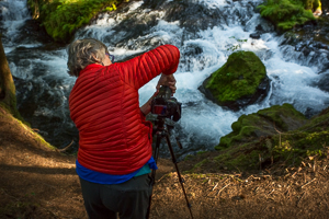
Once again the forecast called for bright sunlight so we had to wake up extra early at 4:30 to ensure our waterfall of choice was in shade. This morning we drove the group once again into Washington, to a little known waterfall in the Washougal River, called Dougan Falls. This waterfall is unique in that the pool below it doubles as a swimming hole in the summer for heat stricken locals. For us, as photographers, we planned to use longer exposures to allow the circular motion of the water in the pool to slow down and streak, resulting in some pretty cool photos! Phil and I helped everyone down the slippery exposed rocks to the water level, and by using neutral density filters, allowed our camera shutters to stay open for 30 seconds to 2 minutes, thereby enabling us to see all the concentric circles created by the water as it slowly rotated in the pool below. As the sun rose ever further, we left and turned our sights higher in the mountains.
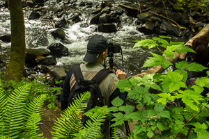
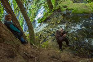
 Panther Creek Falls is higher up in the forest and is a truly unique waterfall where the creek dumps over multiple cliffs and the waterfall itself looks like the convergence of two or even three falls! The viewing platform above the falls provides a safe vista to view the falls from, as the path to the bottom is obstructed by a 15 ft vertical drop and requires climbing. The view from the top is no slouch though, as one can see the entirety of the falls plunging 100ft below, surrounded by the mountain greenery. As we arrived, the sun began to gently kiss the tops of the upper cascade, allowing us only limited time to take in its beauty before we had to retreat back to the hotel for our midmorning break.
As we gathered again for the afternoon, we set off to another falls which were conveniently shaded from the suns harsh light. Starvation Creek Falls is a giant 227 ft multi-tiered waterfall. Its upper tiers are visible from the main trail, surrounded nicely by the forest greenery, while the lower tier is obstructed by a rather large boulder; from there the creek makes a left turn around the boulder and gently cascades down the rocky creek along the trail before meeting up with the Columbia River. So two sections of the falls are the main focus of taking our group here: the upper section, Phil commanded, and the lower section with the cascades, I commanded. Both sections provide unique and plentiful views of the falls, without being able to see one another (which is a plus for photographers!). After our group had sufficiently conquered the falls, we headed out into Hood River, to finish up shooting an oft overlooked section of the gorge.
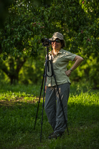
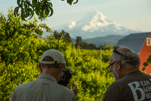
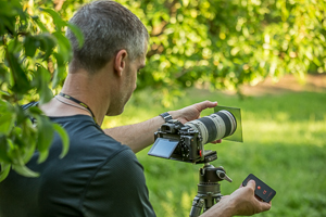
 Hood River benefited greatly from the Missoula Floods. They deposited ungodly amounts of fertile sediment in the Hood River Valley and made the area rich in soil capital. Orchards and vineyards now benefit from those deposits, the Hood River Valley is now a beautiful smorgasbord of overlapping hills with row upon row of perfectly pruned greenery, ripe for the picking! Our first stop was in the middle of an pear orchard to take the beautiful views of Mt Hood and a little red barn, flanked by the rows of pear trees which will be fruitful come harvest time in the late summer. The barn is so perfectly placed, one can see a mix of it and Mt Hood and the pear trees from 3 different rows! Phil and I walked around with our group helping to maximize their time by showing different compositions and using longer telephoto lenses to compress the scene and make Mt Hood and the barn appear larger.
 Our final stop of the workshop, was along one of the most beautiful ridges in the Hood River Valley, and overlooks a large vineyard on hilly slopes finally culminating with a spectacular view of Mt Hood itself. The sweeping hills, the tree lines, the perfect rows of vineyard and orchard, all with a view of the white-capped Mt Hood, its breathtaking. The skies didnt light up for us that night, although we did catch a couple orange streamers from the high clouds directly above us, before the sun quietly retreated below the hills to our left. Its still a nice view and I think one thats hard to beat even by the Vista House. After an hour drive back to the hotel in Troutdale, we said our goodbyes and exchanged handshakes for a two days very well done!
Thank you to all our workshop participants, Phil and I had a blast showing you our favorite spots in the Columbia River Gorge!
Until next time...
Scott, Phil and the rest of the Aperture Academy team
P.S. If you'd like to join us at one of our workshops, you can find the schedule/sign up here.
 |
 |
 |
 |
|
 |
 |
 |
 |
 |
|
 |
 |
 |
|
 |
 |
 |
 |
 |
 |
 |
 |
|
 |
 |
 |
 |
 |
 |
 |
 |
 |
 |
 |
 |
 |
 |
 |
 |
 |
 |
|
 |
 |
|
 |
Other Cool Stuff→ Past Workshop Photos → 72dpi.com → How-To Articles → Photographer of the Month |
|
Contact Us→ Contact Us → About Us → Site Map |
© 2009-2024 Aperture Academy, Inc.